Mobility Plan
CONNECTED
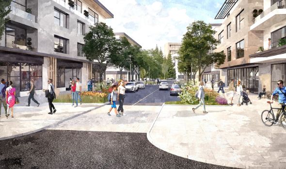
Bowers District is a highly walkable area that focuses on pedestrian and cyclist comfort, safety, and connectivity. This is achieved by mitigating short-cutting through the site, designing traffic calmed streets, and integrating fine-grain street mobility with a network of trails and greenways.
Mobility Overview
Transportation network Plan
The Bowers District Transportation Plan is focused on 3 core principles:
- Designing for active transportation
- Designing for all ages and abilities
- Creating Green Streets
The result of this approach is a highly connected street and trail network with a focus on green public spaces for walking and cycling.
- Wide sidewalks with landscape ‘buffers’ to vehicular traffic
- Dedicated bike lanes, greenways, and multi-use paths
- Pedestrian-oriented intersection design with shorter crossings
- Shifting travel to active modes and shortening trip distances
- Wide landscape buffers/boulevards wherever possible
- Landscaped curb extensions at intersections
- Rain gardens integrated throughout the streetscape
- Accommodating large canopy trees throughout the streetscape
- Minimum pedestrian through-zones to accommodate easier passing and “rolling” (e.g., wheelchairs, strollers)
- Shorter crossing distances and crossing times at intersections
- Curb drops and ramps at all crossings
- Cycle tracks and sidewalks for safety and comfort for all ages
- Increasing safety for all modes


